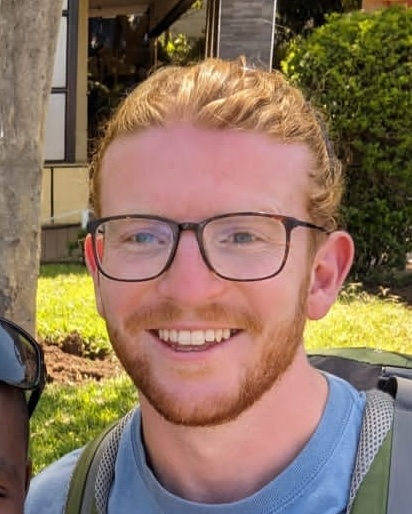
Building GIS systems that help First Nations communities look after their homes and infrastructure. Field inspections become live dashboards, decisions run on real data, and local teams are trained to run it all themselves.
Experience
From intern to specialist - my GIS journey.
Jan 2025 – Present Vancouver, Canada
GIS Specialist
Tapestry Research Group
Lead the design and deployment of GIS & Asset Management Systems using PostgreSQL/PostGIS, ArcGIS Pro and ArcGIS Online, supporting infrastructure and housing assessments in remote First Nations communities.
Build relational asset databases and field-to-dashboard workflows (Survey123, Field Maps) for real-time deficiency reporting and maintenance tracking across remote sites.
Automate spatial data updates with Python, ArcPy and the ArcGIS API for Python, keeping data in sync across disconnected environments.
Perform advanced LiDAR and terrain analysis, including DTM/DSM generation and volumetric modelling.
Work directly with Chief and Council, Elders and community leadership to shape project requirements, and train First Nations staff to configure and maintain their own systems.
Mar 2022 – Aug 2024 London, UK
GIS Analyst
Ringway
Delivered a 95% KPI for efficiency and work-order closure, and helped reclaim ~80% of outstanding items to reduce project backlogs.
Analyzed spatial data and turned complex datasets into detailed maps, charts and reports that supported decision-making and project goals.
Maintained databases for accuracy and integrity, and used Excel (pivot tables, KPIs, automation) to boost team productivity.
Liaised with contractors and engineering teams to resolve project issues.
Nov 2021 – Mar 2022 London, UK
GIS Technician
Cyient
Supported the Rural Payments Agency project, processing and mapping data for subsidy distribution and maintaining precise land parcel databases.
Classified habitat and land cover from remotely sensed imagery to determine the validity of subsidy claims, consistently surpassing QA targets.
Jul 2021 – Oct 2021 Herbertsdale, South Africa
GIS Intern
Wildlife & Ecological Investments
Generated high-resolution vegetation classification maps of Gondwana Game Reserve using Sentinel-2 imagery to analyze regional distribution patterns.
Modeled endangered species population data within Gondwana Game Reserve against topographic gradients to evaluate altitudinal variations.
Executed advanced spatial analysis—including Kernel Density, Density-based Clustering, and Optimized Hot Spot Analysis—to deliver actionable intelligence for Gondwana Game Reserve’s Anti-Poaching Unit.
2018 – 2021
Earlier roles
Data-focused roles in admissions at London South Bank University, community operations at IWG, and market research at MBI, where accuracy and organization came first.
Projects
A few examples of the systems and workflows I build, from data capture through to analysis and reporting.
Asset Management Systems
Problem
Asset records, field inspections and maintenance work were disconnected, making deficiencies slow to report and track.
Approach
Designed a relational PostgreSQL/PostGIS asset database with custom schemas, automated IDs, editor tracking and versioning, connected to field and dashboard apps.
Tools
PostgreSQL/PostGIS, ArcGIS Pro, ArcGIS Online, Survey123, Field Maps, QuickCapture, Dashboards
Outcome
Real-time deficiency reporting, maintenance tracking and work-order management in one workflow.
LiDAR Analysis Workflow
Problem
Large LiDAR datasets needed turning into usable terrain, canopy and volume information.
Approach
Built a repeatable process covering tiling, classification, DTM/DSM/CHM generation, tree detection, segmentation and volumetric modelling.
Tools
ArcGIS Pro, LiDAR / remote sensing tools, Python
Outcome
Consistent surface and canopy products, plus OLS airport surfaces, supporting operational planning.
Spatial Data Automation
Problem
Keeping data aligned across desktop, ArcGIS Online and backend databases was manual and error-prone.
Approach
Wrote Python/ArcPy and ArcGIS API for Python scripts, run as scheduled tools, to automate updates.
Tools
Python, ArcPy, ArcGIS API for Python, ModelBuilder, Power Automate
Outcome
Less manual handling and more reliable, up-to-date data across environments.
Many of my projects are confidential or covered by NDAs for the communities and clients I work with. Further information can be provided upon request, though client information will be redacted.
Skills & Education
Skills
GIS software
ArcGIS Pro
ArcGIS Online
Field Maps
Survey123
QuickCapture
Dashboards
QGIS
Data & programming
PostgreSQL / PostGIS
SQL (MySQL)
Python / ArcPy
ArcGIS API for Python
ModelBuilder
Power Automate
Microsoft Office
Field & remote sensing
LiDAR processing
DTM / DSM / CHM
Tree detection
Volumetric modelling
Spatial analysis
Data analysis
Education
BSc (Hons) Geography
University of Brighton, 2013–2016
International Baccalaureate
Dartford Grammar School, 2006–2013
Beyond the Map
To be honest, I stumbled into GIS. I first encountered it during a module in my Geography degree at Brighton, but at the time, I never imagined it turning into a career. After university, I spent a few years exploring different jobs, looking for the right fit.
That search took me to Bolivia in 2019, where I spent three months volunteering at Parque Machía—caring for rescued animals, helping keep the sanctuary running, and occasionally ending up with a coati on my lap. While there, I saw researchers using spatial data to map the local forest and track deforestation. It was a lightbulb moment: seeing maps used in such a practical, real-world context put GIS firmly back on my radar.
When COVID hit a year later and gave me time to step back and rethink my path, GIS kept coming back to me. Remembering the work in Bolivia, I packed up and headed to South Africa for an internship with an Anti-Poaching Unit on a game reserve. Using spatial data to protect wildlife was the perfect bridge between my love for the natural world and my technical career—and my first glimpse into how geospatial work creates a real, tangible difference on the ground.
Outside of work, you’ll usually find me outdoors—hiking, bouldering, or at the gym balancing out the hours spent behind a screen. Bouldering is my favourite because it’s fundamentally about problem-solving: working through a route one move at a time, failing a few times, and getting that rewarding click when you finally solve it. That same iterative mindset carries directly into how I approach complex GIS challenges.
Travel has been equally defining. Living and working in South Africa, Bolivia, and now Canada has taught me to embrace new environments, listen to diverse perspectives, and stay adaptable—qualities that are essential when collaborating with different communities today.
None of this journey would mean as much without my family and friends keeping me grounded. Moving between countries has made me treasure time spent with them even more, and for me, the best days are simple: good food, great company, and fresh air.
Ultimately, people are the thread connecting everything I do. Whether it’s rangers on a reserve in South Africa, sanctuary teams in Bolivia, or my former colleagues in London (pictured on my last day with them), the people you work with matter just as much as the spatial systems you build. Building genuine relationships and bringing warmth to the daily grind makes every project better—and that’s the spirit I bring to every team and community I work with today.